
Lexington County, SC, October 26, 2025 News Summary The Lexington County Sheriff’s Department is actively searching for 27-year-old Cordell Wyman Clark, wanted on assault and weapons charges. Authorities urge anyone with...

Lexington, South Carolina, October 26, 2025 News Summary The Lexington One School District has settled a lawsuit for $75,000 after a 15-year-old student’s First Amendment rights were allegedly violated. Marissa Barnwell...

Lexington, South Carolina, October 25, 2025 News Summary A Lexington Two school bus was rear-ended by a car while transporting approximately 20 students home on Fish Hatchery Road. Emergency responders quickly...

Lexington, October 25, 2025 News Summary A tragic accident in Lexington County has resulted in the death of a local driver, Byron Paul Gunter, after his truck collided with a tree....

Lexington County, October 25, 2025 News Summary A single-vehicle collision in Lexington County has resulted in the death of Byron Paul Gunter, who was pronounced dead at the scene after crashing...

Lexington, South Carolina, October 25, 2025 News Summary In Lexington, South Carolina, traffic has resumed on South Lake Drive after a crash caused temporary disruptions. The incident involved a driver failing...

Lexington County, South Carolina, October 25, 2025 News Summary A tragic accident occurred in Lexington County, South Carolina, resulting in the death of a 37-year-old driver late Thursday night. Byron Paul...

South Carolina, October 25, 2025 News Summary Week 10 of South Carolina high school football showcased impressive performances with dominant victories, close matches, and several shutouts. Noteworthy games included Batesburg-Leesville defeating...

Pelion, October 25, 2025 News Summary A tragic truck crash in Lexington County has resulted in the death of Byron Paul Gunter, 37. The accident occurred late Thursday at the intersection...

Columbia, South Carolina, October 23, 2025 News Summary First Community Corporation, based in Columbia, South Carolina, has reported significant financial growth for the third quarter of 2025, with a net income...

Lexington, South Carolina, October 20, 2025 News Summary The Lexington County School District One has awarded $10,000 in grants through the Michelin VEX Robotics Grant Awards to enhance STEM education for...
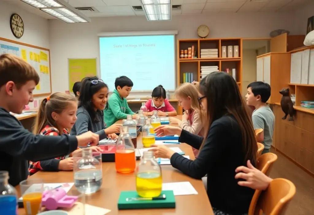
Lexington, SC, October 19, 2025 News Summary Five educators from Lexington School District Two have received Bright Ideas grants from Mid-Carolina Electric Cooperative for their innovative teaching projects. These grants aim...

Lexington, October 19, 2025 News Summary Voodoo Brewing Co. is set to open a new brewpub in downtown Lexington on November 7, creating a vibrant gathering spot for craft beer lovers....
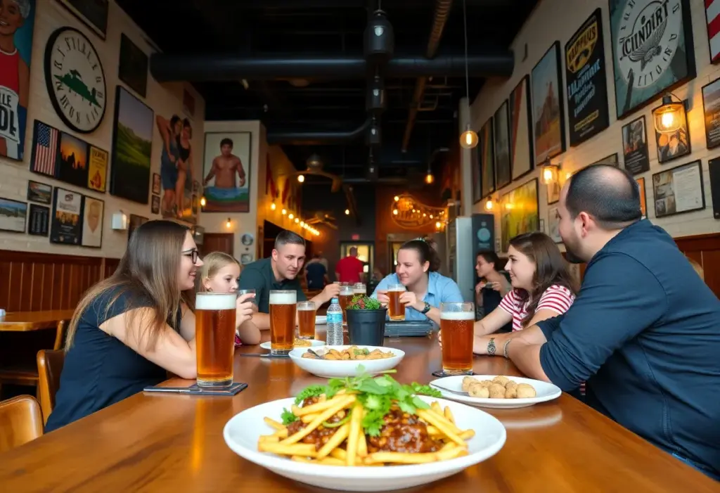
Lexington, SC, October 18, 2025 News Summary Voodoo Brewing Co., renowned for its craft beer, is launching its new brewpub in Lexington, South Carolina, on November 7. The pub, owned by...
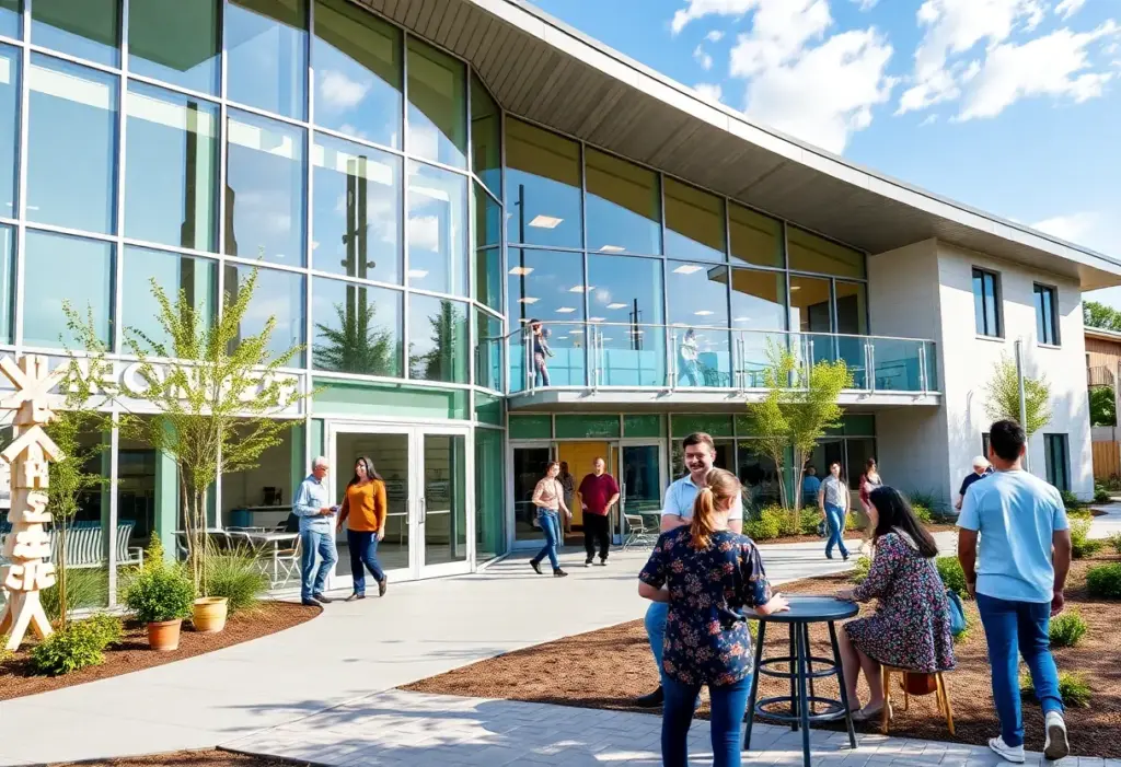
Lexington, October 15, 2025 News Summary Mission Lexington, a primary care organization in Lexington, is expanding its operations by relocating to a larger facility at 1426 N. Lake Dr. The new...

Lexington, SC, October 15, 2025 News Summary Mission Lexington is expanding its facility to better support families in Lexington County facing crises. The new location will increase operational capacity, allowing enhanced...

Columbia, October 14, 2025 News Summary Enzo’s Delicatessen has relocated to 612 Whaley St, Columbia, sharing space with Alimentari Don Luigi. This strategic move aims to protect their Italian wine shop...

Lexington, October 14, 2025 News Summary The Chick-fil-A Saluda Pointe in Lexington is reopening on October 15, after renovations that included the installation of a new double drive-thru system. This upgrade...

Columbia, South Carolina, October 26, 2025 News Summary The University of South Carolina Association of Lettermen held its annual golf tournament at Fort Jackson Golf Club, attracting 50 competing teams. Proceeds...

Irvine, CA, October 26, 2025 News Summary As the regular season nears its conclusion, Orange County SC is poised for a decisive clash against Indy Eleven. A win will secure OC...

Soda City, October 23, 2025 News Summary Soda City is gearing up for a vibrant Halloween season with an array of events running from October 23 through Halloween night. Families and...

Lexington, October 22, 2025 News Summary Lexington, South Carolina, is approaching a crucial town council election with three at-large seats up for grabs on November 4. Incumbents Gavin Smith, Todd Carnes,...

Columbia, SC, October 21, 2025 News Summary South Carolina has officially launched early voting, allowing eligible residents to cast ballots prior to the November election. While Richland County sees enthusiastic participation,...

Columbia, SC, October 20, 2025 News Summary Columbia, South Carolina, continues to attract tourists with open attractions and events despite the federal government shutdown. Key sites like Congaree National Park, the...

Phoenix, October 20, 2025 News Summary Phoenix Rising FC secured a vital 1-0 win over San Antonio FC, enhancing their playoff prospects. The decisive goal was scored by Charlie Dennis in...

Lexington, SC, October 20, 2025 News Summary Dutch Fork High School secured a resounding 49-0 victory over rival Lexington High School, showcasing a strong performance that included standout players Jaxon Knotts...

Columbia, South Carolina, October 19, 2025 News Summary The South Carolina Election Commission is facing significant leadership changes after an investigation revealed unexpected costs linked to a $28 million ballot scanner...
Lexington County, SC, October 26, 2025 News Summary The Lexington County Sheriff’s Department is actively searching for 27-year-old Cordell Wyman Clark, wanted on assault and weapons charges. Authorities urge anyone with...
Lexington County, October 25, 2025 News Summary A single-vehicle collision in Lexington County has resulted in the death of Byron Paul Gunter, who was pronounced dead at the scene after crashing...
Lexington, South Carolina, October 25, 2025 News Summary In Lexington, South Carolina, traffic has resumed on South Lake Drive after a crash caused temporary disruptions. The incident involved a driver failing...
Lexington County, South Carolina, October 25, 2025 News Summary A tragic accident occurred in Lexington County, South Carolina, resulting in the death of a 37-year-old driver late Thursday night. Byron Paul...
Leesville, October 24, 2025 News Summary Authorities are searching for Cordell Wyman Clark, a 27-year-old man wanted for first-degree assault and other firearms-related charges following a domestic incident in Leesville. The...

Lexington County, South Carolina, October 23, 2025 News Summary In a significant crackdown on child sexual exploitation, three men have been arrested in Lexington County, South Carolina. The arrests, resulting from...

Lexington County, October 23, 2025 News Summary Three men from Lexington County, South Carolina, have been arrested in separate cases involving the sexual exploitation of minors. Trey Sullivan, Brandon Bailey, and...

Lexington County, South Carolina, October 23, 2025 News Summary Three men from Lexington County have been arrested for child sexual exploitation, facing a total of six felony charges. Trey Sullivan, Brandon...

Lexington, October 23, 2025 News Summary The Lexington Police Department is requesting assistance from the public in locating Michael Keith Smith, a 36-year-old man from Saluda. He is wanted on charges...

Columbia, South Carolina, October 17, 2025 News Summary Former Representative R.J. May is facing legal challenges, including ten counts of distributing child pornography and a tax investigation. The South Carolina House...

Columbia, South Carolina, October 10, 2025 News Summary In South Carolina, the gubernatorial race intensifies as Republican candidates, including Josh Kimbrell, support the Moms for Liberty’s Parental Rights Pledge. This initiative...

Lexington, October 9, 2025 News Summary The Lexington community is remembering Abraham the Camel, who passed away at nearly 30 years old after surgery for an intestinal blockage. Known for his...

Lexington, South Carolina, October 9, 2025 News Summary Abraham the camel, known as the ‘Camel for Christ,’ has passed away after 29 years of service in the Midlands community. He was...

Columbia, South Carolina, October 9, 2025 News Summary State Representative R.J. May III is under scrutiny following a federal raid at his home where electronic devices were seized. Although facing a...

Kershaw, September 30, 2025 News Summary A 1.8 magnitude earthquake struck Kershaw, South Carolina, early Monday morning at 3:08 a.m. The tremors occurred 6 miles south-southwest of Kershaw at a depth...

Columbia, South Carolina, September 28, 2025 News Summary The South Carolina Supreme Court has ruled for the state to share voter registration data with the U.S. Department of Justice, overturning a...

Lexington, SC, September 26, 2025 News Summary The Lexington County Council has rejected the Avanti Townhomes development plan, which proposed 83 townhome units. Concerns over overcrowding at Deerfield Elementary influenced the...

Lexington, SC, September 25, 2025 News Summary A teacher from Lexington School District One has been placed on administrative leave while an investigation into their social media posts takes place. Allegations...
Columbia, South Carolina, October 26, 2025 News Summary The University of South Carolina Association of Lettermen held its annual golf tournament at Fort Jackson Golf Club, attracting 50 competing teams. Proceeds...
Irvine, CA, October 26, 2025 News Summary As the regular season nears its conclusion, Orange County SC is poised for a decisive clash against Indy Eleven. A win will secure OC...
Columbia, SC, October 20, 2025 News Summary Columbia, South Carolina, continues to attract tourists with open attractions and events despite the federal government shutdown. Key sites like Congaree National Park, the...
Phoenix, October 20, 2025 News Summary Phoenix Rising FC secured a vital 1-0 win over San Antonio FC, enhancing their playoff prospects. The decisive goal was scored by Charlie Dennis in...
Lexington, SC, October 20, 2025 News Summary Dutch Fork High School secured a resounding 49-0 victory over rival Lexington High School, showcasing a strong performance that included standout players Jaxon Knotts...

Brooklyn, NY, October 19, 2025 News Summary Carolina Ascent FC is preparing to face Brooklyn FC at Maimonides Park with the aim of improving their standings. Currently tied on points, both...

Columbia, South Carolina, October 18, 2025 News Summary Dutch Fork High School will host Lexington High School on October 17 for a crucial high school football matchup. Dutch Fork seeks to...
Lexington, Kentucky, October 15, 2025 News Summary This week in Lexington, Kentucky, a thrilling lineup of sports events is set to take place, featuring college, high school, and professional competitions in...

Columbia, October 14, 2025 News Summary Columbia is witnessing a significant expansion in its craft brewery scene, ignited by the ‘pint law’ passed in 2013. This law allows breweries to sell...