
News Summary
Columbia, SC is preparing for a dramatic weekend of weather, starting with sunny skies and warm temperatures on Friday. However, the forecast quickly changes with clouds and a significant chance of thunderstorms on Saturday and Sunday. Residents are urged to secure outdoor items and brace for possible power outages due to high winds and inclement weather. Following this wild weather, a cold front may bring winter conditions early next week. Stay informed and be prepared!
Severe Weather Alert as Columbia, SC Prepares for a Wild Weekend!
Columbia, SC, get ready! This weekend, we’re in for an exciting mix of weather that might just have you on the edge of your seat. But before we dive into the details, let’s enjoy one last sunny day on Friday with mostly clear skies and temperatures peaking around a comfy 82°F. That’s right, a short-lived warm spell before things take a chilly turn.
Friday’s Farewell to Sunshine
As you make your weekend plans, take advantage of those light south winds rustling through the air at about 8 mph. Perfect weather for a stroll in the park! However, as the sun sets, expect some clouds to creep in, bringing the night’s low down to a mild 56°F.
Cloudy Saturday Incoming
Saturday promises to be a bit more overcast with highs lingering around 81°F. While you might still hope for clear skies, a 30% chance of rain slips into the forecast after 2 a.m. on Sunday. So if you have outdoor plans Saturday night, keep a close eye on those clouds.
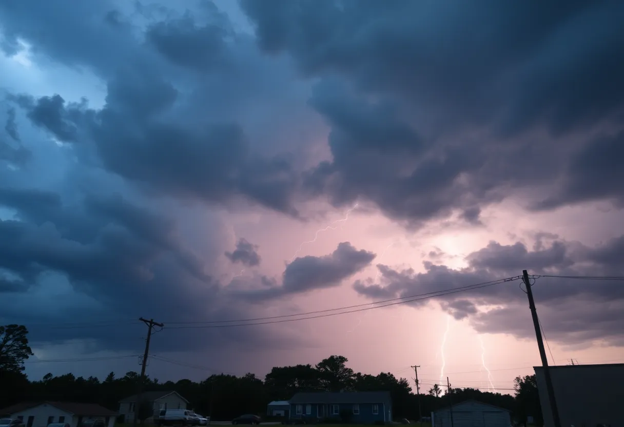
Brace for Storms on Sunday!
Now, the excitement really kicks in on Sunday, with a significant jump in rain chances to 70%. Expect scattered thunderstorms throughout the afternoon, which might just put a damper on your weekend activities. If you’re traveling in Richland and Lexington counties, be prepared for potential slowdowns caused by these storms.
As the sun goes down, the rain doesn’t stop just yet. Sunday night keeps the stormy vibes alive with a 40% chance of more thunderstorms and temperatures cooling off to around 63°F. Don’t store your umbrellas away just yet!
When Will It All End? A Chilly Week Ahead
But wait, there’s more! It looks like Monday might also bring another round of showers and storms after 2 p.m. with highs reaching back to 81°F. Just think of it as nature’s way of keeping us on our toes!
And if that’s not enough to make you check your weather app twice, by midweek, we could see **some winter weather moving in**! A low pressure system will be gliding along the coast, and there’s a good chance we’ll experience a wintry mix of freezing rain, sleet, and maybe even snow on Wednesday. Prepare for temperatures to plunge to a chilling low of 30°F by Wednesday night, and a 30% chance of precipitation means we should brace ourselves for a slippery ride ahead.
Staying Safe on the Roads
In anticipation, the South Carolina Department of Transportation is already taking precautionary measures by salting the roads, especially the highways and main routes. This is important because those chilly temperatures could lead to slick roads and black ice! Drive carefully.
For those who may have forgotten, the Midlands just dealt with significant snowfall back in January, so this isn’t entirely out of nowhere. Stay informed! A Weather Impact Alert is already in effect due to the expected severe weather. The eastern part of South Carolina is rated under an enhanced risk for severe storms, while the central Midlands is considered under a slight risk.
Time to Prepare
Residents should begin securing outdoor items and be wary of potential power outages caused by those strong winds. As we look ahead, the forecast hints at sunshine returning the following week once this wild weather storm wraps up. Phew! Let’s hope for clear skies and dry conditions.
So, Columbia, hang tight as we navigate this whirlwind of weather. From sun to storms to wintry mixes, it’s certainly a weekend of surprises ahead!
Deeper Dive: News & Info About This Topic
HERE Resources
Winter Storm Approaches Columbia: Prepare for Snow and Cold
Severe Thunderstorm and Tornado Warnings Hit Columbia, SC
Winter Weather Alert Issued for South Carolina
Severe Thunderstorm and Tornado Warnings Hit Columbia
Severe Thunderstorm and Tornado Warnings Issued in Columbia, SC
Severe Weather Hits Columbia, South Carolina
Tornado Touches Down Over Lake Murray, South Carolina
Thunderstorm and Tornado Warnings Hit Columbia, SC
Tragic House Fire Claims Life of 2-Year-Old in Lexington County
Severe Weather Warning in Columbia, South Carolina
Additional Resources
- The State: Severe Weather Alert
- Wikipedia: Weather
- WLTX: Severe Storm Potential in South Carolina
- Google Search: Severe weather South Carolina
- WIS TV: Wintry Mix Arrives
- Google Scholar: Severe weather forecast
- The State: Weather News Update
- Encyclopedia Britannica: Weather forecasting
- WLTX: Severe Weather Risk on Sunday
- Google News: South Carolina weather